1,600 kilometers through the Western Alps with my „Travel-Bimota“
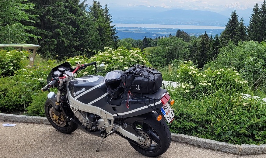
After a comprehensive technical overhaul and various modifications (→ see here), my YB8 E is back on the road as a touring motorcycle after thirteen years of being stationary. In mid-June 2023, I set off towards the French Alps. Just to be safe, I also load up my well-traveled DB3. You never know what unexpected problems might arise after such a long period of inactivity. After all, it would be frustrating to invest two days in traveling to and from the destination, only to be unable to ride or be severely limited—especially when a reliable alternative is available.
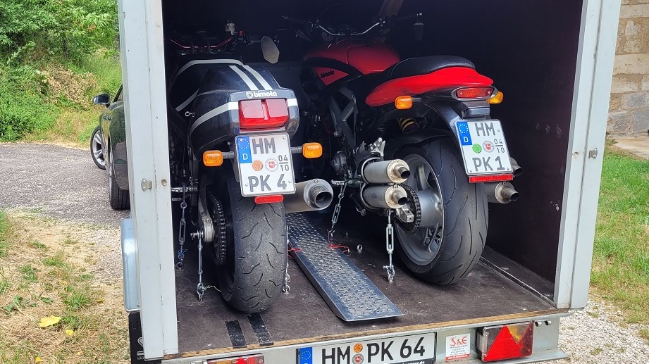
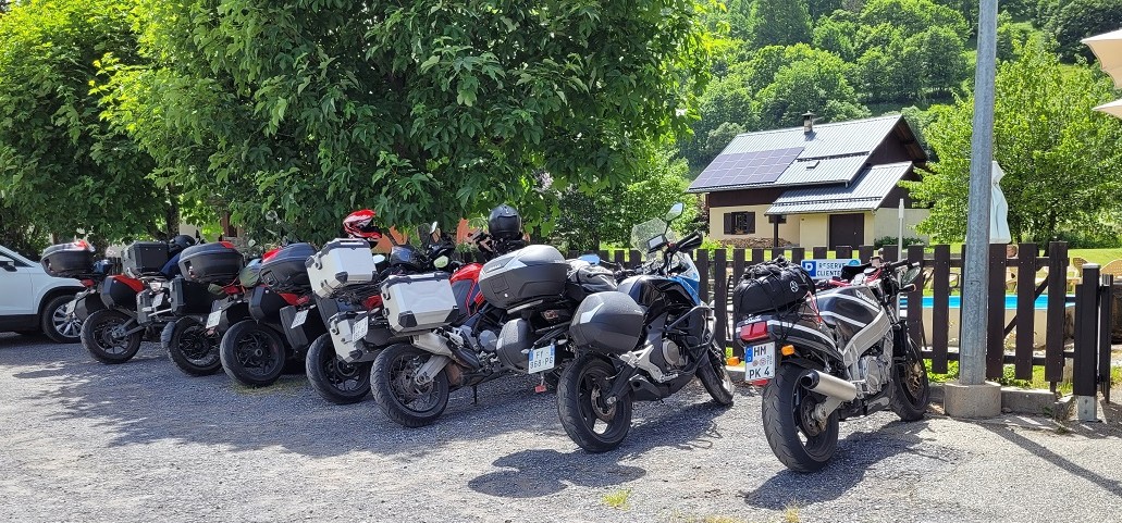
The tour begins with around 800 kilometers on the highway to the vicinity of Besançon, where I leave my car, trailer, and backup motorcycle at a friend’s place. With light luggage—a waterproof bag strapped to the tail section and tools, chain lubricant, rain gear, and other essentials stored in the “trunk”—everything I need for the five-day journey is packed on and in the YB8.
Highlights
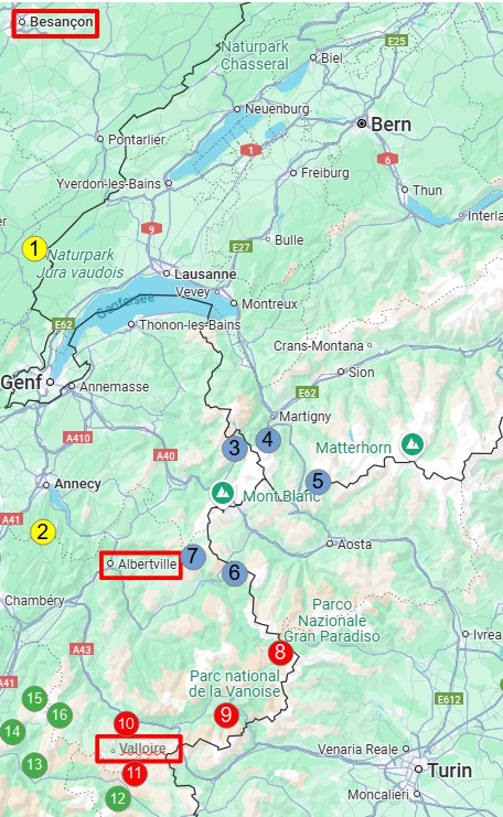
1 Jura-Mountains
2 Massif de Burges
3 Col de Montetz
4 Col de Forclaz
5 Grand San Bernard
6 Petit San Bernard
7 Cormet de Roselend
8 Col de l’Iseran
9 Col de Mont Cenis
10 Col de Telegraph
11 Col du Galibier
12 Col du Lautaret
13 Alpe d’Huez
14 Col de la Confession
15 Col de la Croix de Fer
16 Col Du Glandon
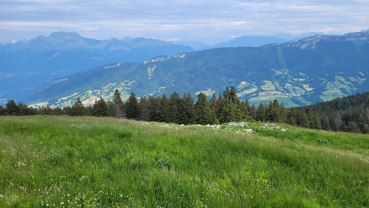
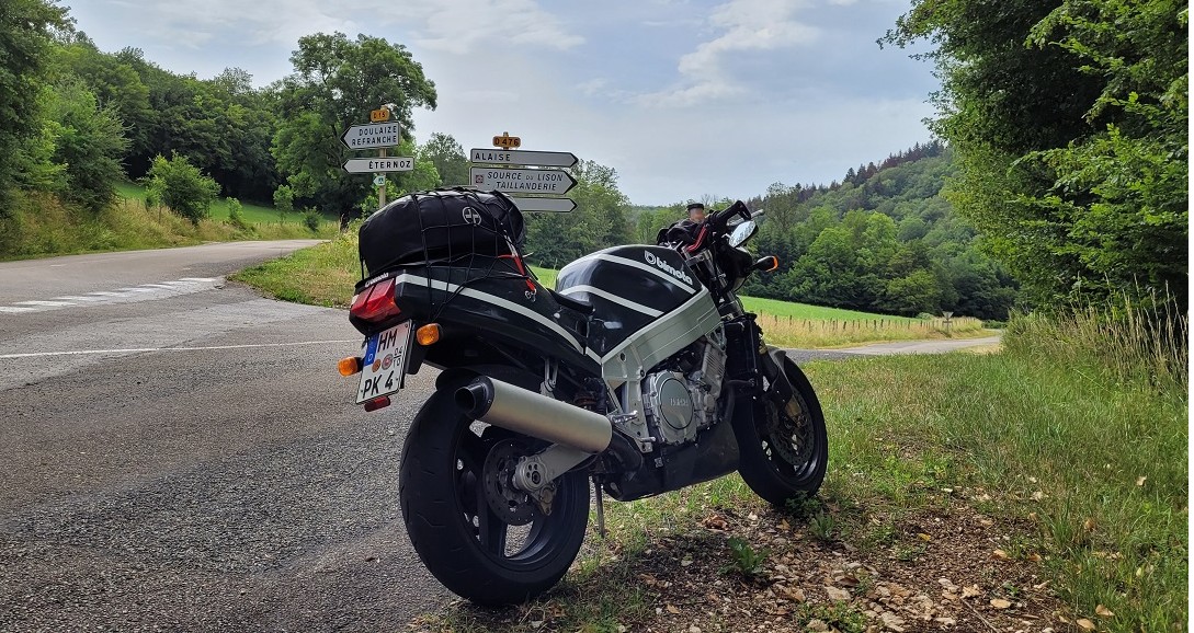
The first kilometers to Champagnole take me along smaller but well-maintained roads through varied landscapes. From there, the N5 leads up to the crest of the Jura Mountains along the French-Swiss border. The ridge road, D1005, offers numerous curves and viewpoints overlooking Lake Geneva. The first real pass-riding experience comes when descending via Gex towards Geneva.
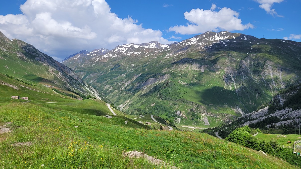
The next destination is Annecy, on the northern shore of the lake of the same name. From there, I take the D41 up into the Bauges Massif, reaching the small village of La Motte-en-Bauges. The Bauges are a mountain range that, with peaks over 2,000 meters, invites extensive rides. However, I take the small, winding D10 back down to Lac d’Annecy and continue on to Albertville, my destination for the day. In the center of this Olympic city from 1992, I’ve booked an apartment for two nights, from where I will explore the surrounding routes over the next two days.
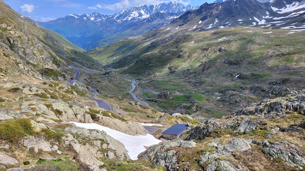
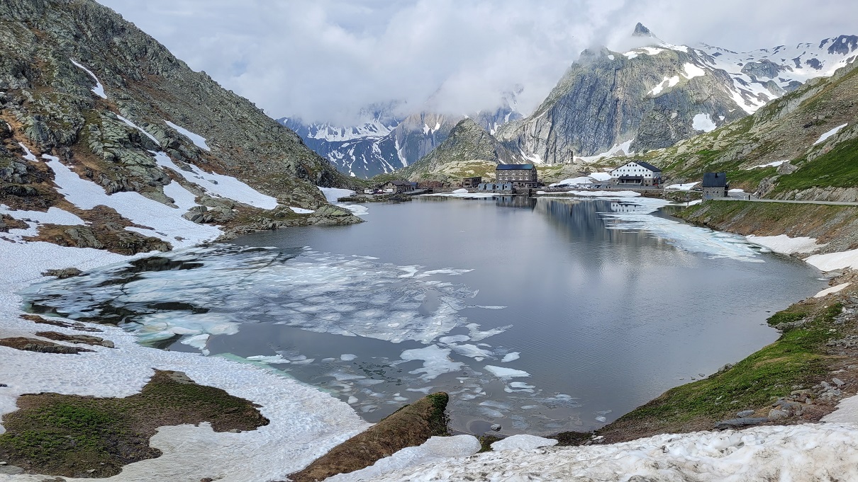
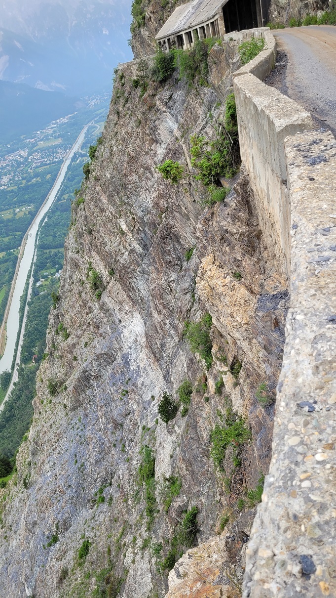
On the second day, the first real Alpine tour is on the agenda. From Albertville, I ride northwest, often with views of the snow-covered Mont Blanc massif, until I reach Chamonix. I then cross the first smaller pass, the 1,461-meter-high Col des Montets, towards the Swiss border and continue over the Col de la Forclaz (1,527 m) to Martigny. Martigny serves as the starting point for crossing the Great St. Bernard Pass (2,473 m) into Italy’s Aosta Valley. Since most through-traffic takes the six-kilometer-long tunnel, the old, less-traveled pass road is an absolute pleasure to ride, winding through breathtaking landscapes.
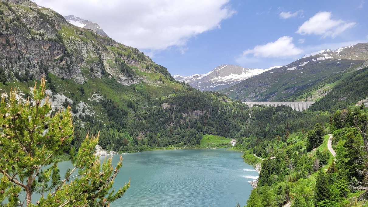
After a relaxed lunch in Aosta, the route continues westward to Pré-Saint-Didier. From there, I climb to the 2,188-meter-high Little St. Bernard Pass, which marks the border with France. A fantastic series of hairpin bends leads down to Bourg St. Maurice before the tour ascends again: via the Route de Beaufortain, I reach the Cormet de Roselend at 1,968 meters.
Since the north side of the pass towards Albertville is closed, I have the beautiful route and its stunning nature almost entirely to myself. Finally, I head back to Bourg St. Maurice and take the N90, reaching Albertville in about an hour. This highly recommended loop covers a total of 370 kilometers and offers a perfect mix of scenic beauty and riding pleasure.
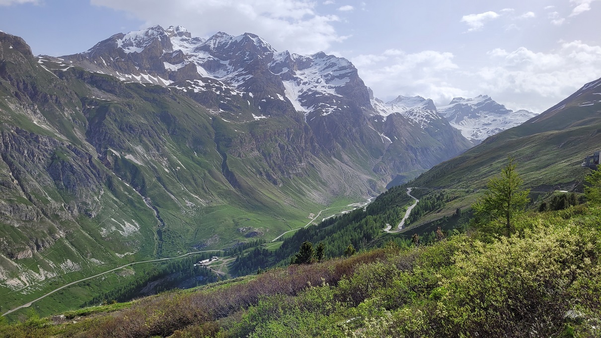
On the third day, a true highlight awaits: the Col de l’Iseran, the highest paved pass in the Alps at 2,770 meters. The journey from Albertville first follows the N90 back to Bourg St. Maurice. In Seez, I turn onto the D902, which leads south through the picturesque Isère Valley. Passing the famous ski resort of Val d’Isère, I continue climbing toward the summit.
Here, a surprise awaits me: the southern side of the pass is closed due to rockfalls—a hotly debated topic among the riders gathered there. Turning back would completely alter the rest of my trip and force a massive detour via the Col de la Madeleine and the Maurienne Valley.
Together with a few other motorcyclists, I decide to take the risk. While large boulders block the road, there’s a narrow strip along the edge that allows motorcycles to pass. This daring section adds an extra touch of adventure to the trip!
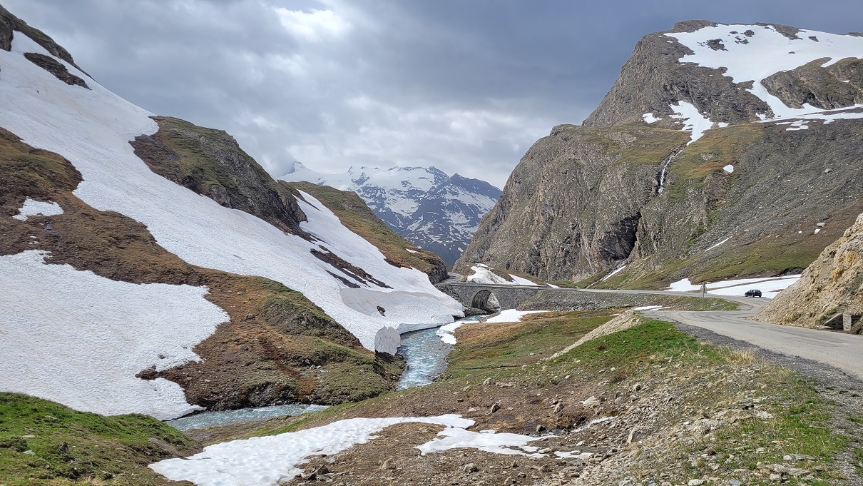
About 30 kilometers beyond Col de l’Iseran, the D902 ends and merges into the D1006. From here, I take the D1006 towards Italy, crossing Col du Mont Cenis at 2,083 meters. After the summit, the route runs alongside Lac du Mont Cenis until it reaches the border, from where the road descends towards Susa.
However, thick clouds gather beyond the pass, and soon it starts to rain. Without much hesitation, I decide against continuing into Italy and instead return over the pass to the northern side, where the weather is once again beautifully clear.
The D1006 towards Modane is well-built but offers only a few curves. So, shortly after Val Cenis, I leave the main road and switch to smaller side roads that lead north into the mountains. By chance, I come across two idyllic reservoirs north of Aussois—perfect for a relaxing break.
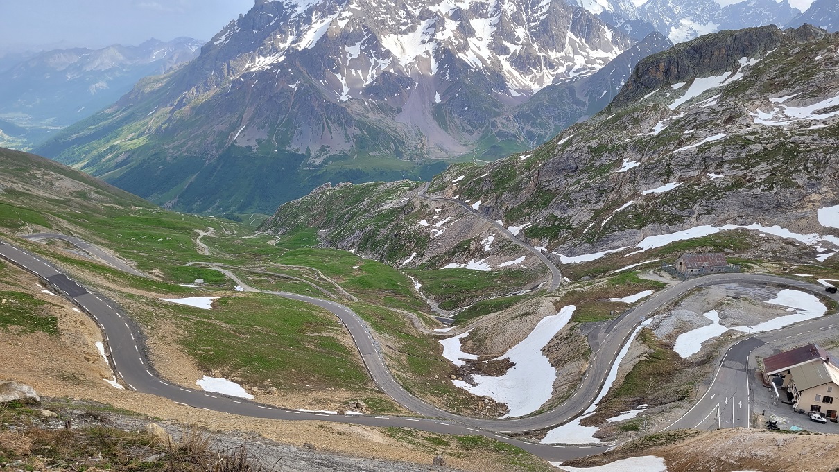
Through the mountains, I descend into Modane and continue to Saint-Michel-de-Maurienne. From there, the D902 leads south over Col du Télégraphe to Valloire, where I have booked a room for the night. After checking in, I set off once again to round off the day with a ride along the winding 15 kilometers up to Col du Galibier, at an elevation of 2,642 meters. By the end of the day, my odometer shows a solid 280 kilometers.
Day 4 Begins with Some Confusion. Around 6:30 a.m., I wake up to the sound of a gentle trickling. Rain? But none was in the forecast! I turn over, trying to ignore it. But since I’m already well-rested, I eventually get up, pull back the curtains—and see thick drops falling onto the balcony. Strange, because the street below is completely dry.
The mystery is quickly solved: It’s not rain, but the automatic watering system for the flower boxes on the balcony above. Well then, time to get going! After a quick shower, a speedy breakfast, and packing up, I’m on my bike by 8:00 a.m. At the top of Col du Galibier, at nearly 2,650 meters, it’s still quite chilly. The icy wind makes sure I’m freezing, but the breathtaking view more than makes up for it.
Nine kilometers south of the pass summit, the D902 merges into the D1091, which I follow westward. The route passes Lac du Chambon and its dam. About a kilometer further, the D211A branches off—a narrow, winding road closed to vehicles over 1.5 tons. It snakes its way through the cliffs, offering more of an adventurous ride than a fast-paced twisty section. But the spectacular views make the detour absolutely worthwhile.
Sharing the famous serpentines up to Alpe d’Huez with hundreds of runners and cyclists, I quickly realize that a major event is happening today—significantly limiting the fun for motorcyclists. In Huez, a small road branches off: the Route de la Confession, leading to a pass of the same name. Much like the D211A, it winds through stunning landscapes. The pass summit is located right in a curve, built on retaining walls directly against a steep rock face.
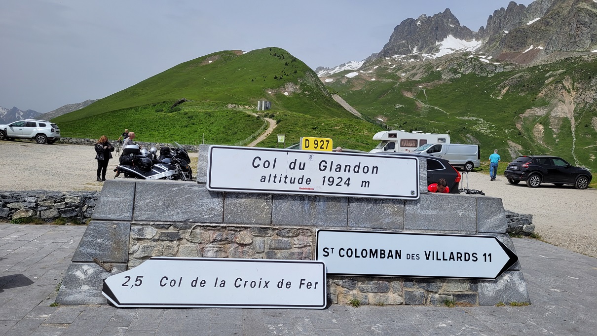
The route eventually ends in Oz, where it merges into the D526. This road takes me further north toward the next highlight: Col de la Croix de Fer at 2,067 meters. Just two and a half kilometers away, another pass awaits—the Col du Glandon—perfectly complementing the tour.
On the way to Col de la Croix de Fer, I notice a faint smell of gasoline from the YB8. When I reach the summit, I inspect the bike but find no obvious leak. However, at Col du Glandon, the smell becomes much stronger. While taking photos a few meters from the parking lot, I suddenly realize the air is thick with the scent of fuel.
Back at my bike, I see a sizable puddle forming underneath, with gasoline dripping from the lower fairing onto the ground. Judging by the amount, it seems likely that a hose has ruptured. I immediately shut off the fuel petcock, which is usually inaccessible on the fully faired YB8 E. Fortunately, the spilled fuel hasn’t ignited on the hot engine or exhaust headers—lucky break!
Now I’m stuck—at nearly 2,000 meters altitude, far from the nearest workshop. A quick look at Google Maps helps with my decision: I’ll try my luck heading northeast. Along the pass road, I might find a workshop in one of the small villages, and in the worst case, I’ve spotted several repair shops on the outskirts of Sainte-Marie-de-Cuines.
Just after noon, I push my YB8 E off the parking lot and coast down the pass without the engine running. The steep incline allows me to reach speeds of up to 80 km/h at times. In Saint-Colomban, the road levels out a bit, but there’s still enough fuel in the carburetors for me to briefly start the engine and get over the flat stretch. From there, it’s a continuous descent to Sainte-Marie. Only at the town entrance does the road flatten out again, so I fire up the engine once more for the final few meters—right up to a gas station on Rue de la Pleine. Conveniently, this gas station sits between two workshops—exactly what I need!
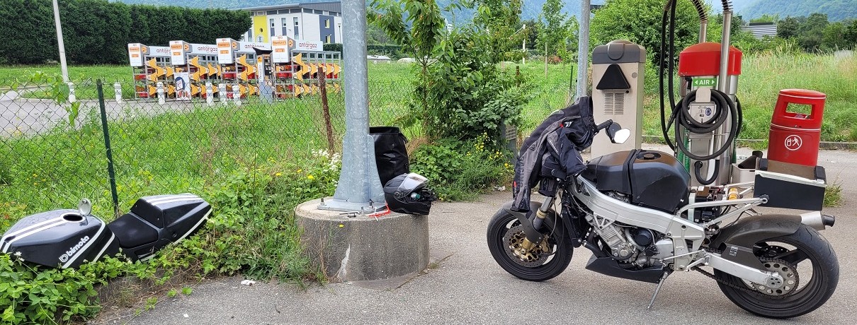
I park the bike in a covered area with a coin-operated vacuum cleaner. Down in the valley, temperatures are well above 30°C, and I’m grateful for the shade. Quickly, I unstrap my luggage and remove the monocoque. To access the fuel lines, the tank has to come off—but it’s only secured with four rubber mounts. And that’s when the problem immediately becomes visible.
The fuel hose at the reserve switch has completely torn off. Although I had replaced all the fuel lines when getting the bike back on the road, I must have routed this one incorrectly during reassembly, putting it under tension until it eventually snapped. The fix would be quick—if only I had a long enough replacement hose. I do have hose clamps, pliers, and a piece of fuel hose in my „trunk,“ but unfortunately, it’s too short.
By now, it’s 1:15 p.m., and the surrounding workshops are on lunch break. When the truck repair shop reopens at 2:00 p.m., I meet a friendly and helpful mechanic. He fetches a suitable hose from the storage room, and within 15 minutes, the YB8 is ready to go again.
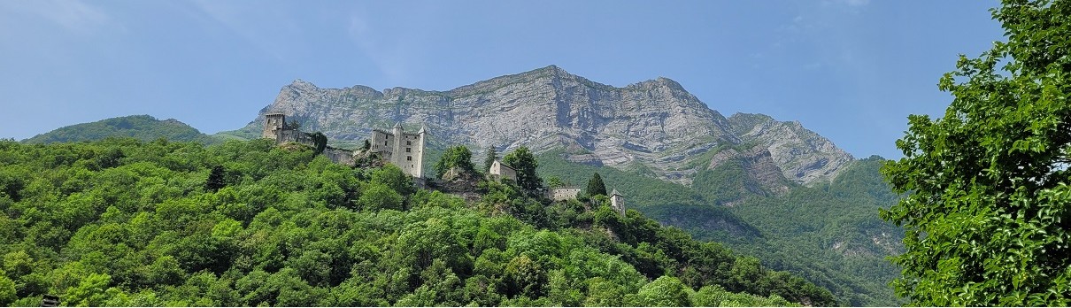
Originally, I had planned to ride Col de la Madeleine that day, but due to the unexpected delay, I shorten the route and head directly north from Sainte-Marie into the Val d’Arc, continuing into the Massif des Bauges. After a short detour to the picturesque Château de Miolans, I take the D911 over Col de la Frêne and follow the mountain range to Rumilly. From there, I ride along the Rhône to Valserhône and then further north into the Jura.
After nearly 300 kilometers for the day, I finally arrive in Champfromier, where I’ve booked a hotel for my last night. A day full of events ends peacefully in this quiet little town, with dinner on the hotel terrace—a perfect conclusion to an eventful ride.
I start the last leg of my journey on the D14 and D991, heading north towards the Jura mountain ridge. The Col de la Faucille (1,323 m) marks the final pass of this tour. Heavy thunderstorms are forecast for the early afternoon in the Besançon area, so I skip additional scenic roads in the Jura and opt for the direct route via the N5 down to Champagnole, where I arrive around 10:00 a.m.. From there I continue on smaller country roads, winding through beautiful landscapes that invite a few photo stops.
By midday, the heat and humidity increase—the first signs of the approaching thunderstorms. In the west, towering cloud formations are already building up. Just before reaching my destination, after about 240 kilometers, the first rain finally falls, but luckily, I am spared from a full-blown storm.
In the end, the trip adds up to around 1,600 kilometers across 15 Alpine passes in 5 days. The weather was fantastic, though mornings at high altitudes were still quite chilly. Despite the small mishap, it was an incredible tour—and definitely not my last trip to the Western Alps. What a ride!
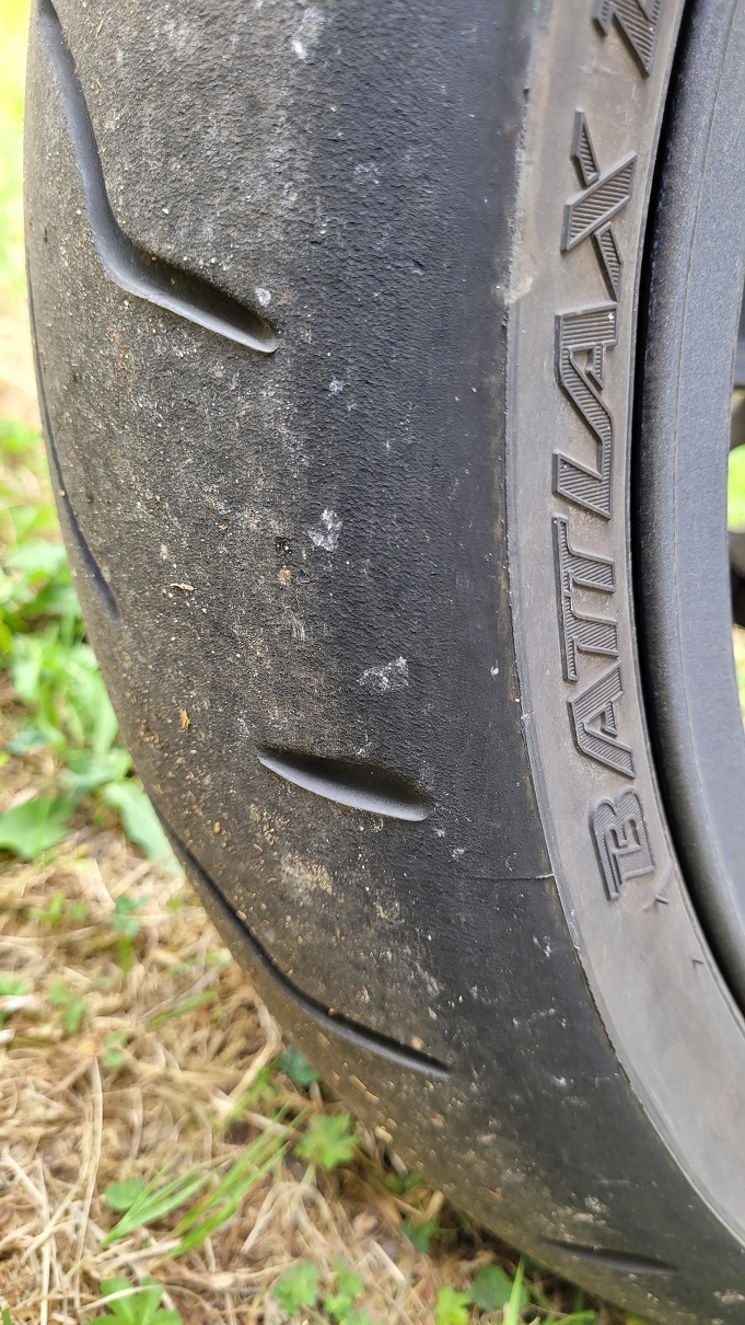
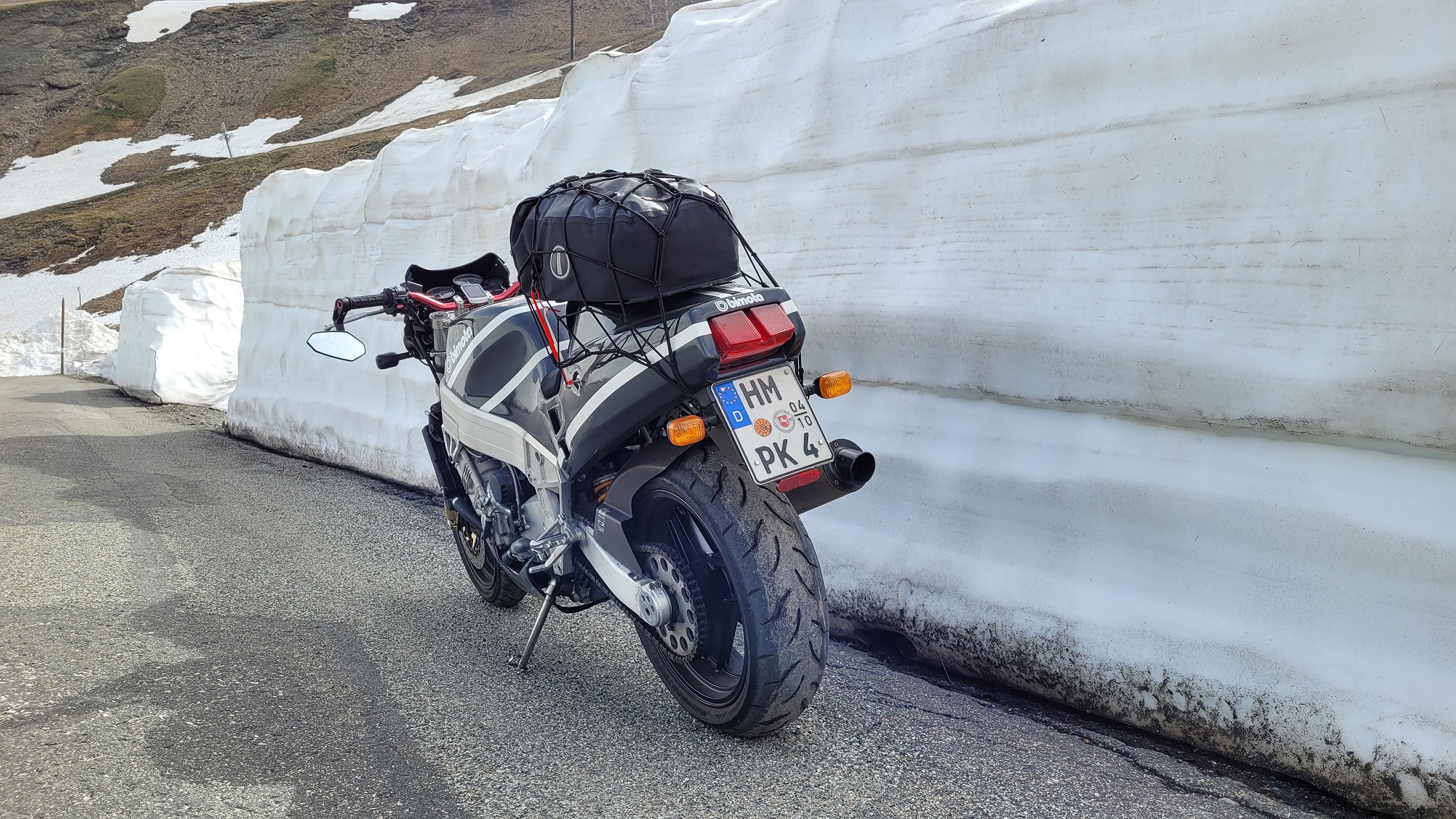
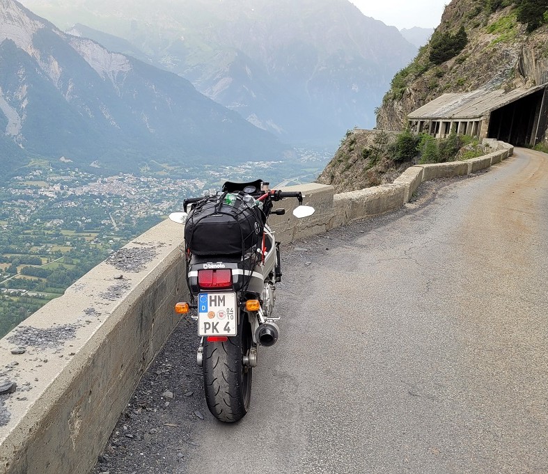
And my YB8 E? It was an absolute blast throughout the entire route, especially on the passes—as you can clearly see from the rear tire. 😉